Mount Kenya is Africa’s second highest mountain jutting out of the Kenyan plains at 5,199m and consisting of a multitude of imposing spires, cliffs, complex ridges and peaks. The highest point is Batian at 5199m, followed by Point Nelion at 5188m and Point Lenana at 4985m. Other major summits on the mountain include Point Pigott at 4957m, Point Dutton at 4885m and Point John at 4883m. Although it straddles the equator, Mt Kenya is sufficiently high enough to receive significant snowfall and to is circled with several glaciers. Of the three main peaks (Batian, Lenana and Nelion), only point Lenana can be reached by trekkers, whilst the others points are reacheable by technical climbing.
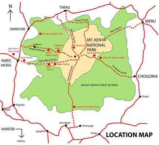
ROUTESEach of Mt Kenya's official routes - Sirimon, Kamweti, Naro Moru, Chogoria and Timau have unique characteristics. The following descriptions are a brief introduction of the main routes to help you choose the route that will make your Mt Kenya expedition both memorable and fun. If you are interested in technical climbing of any of the peaks, please contact us directly for more information.
|
|
SIRIMON
|
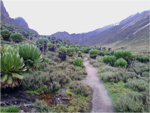
The Sirimon Route is accessed via the North West corner of the mountain at the KWS Sermon Park Gate. This is the most popular and gentle route in Mount Kenya as it approaches the peaks from the Northwest side, offering very gradual changes in altitude and a clear view of the peaks all the way. Unless preferred, camping is not necessary as accommodation is available in mountain huts in dormitory rooms with toilets at Old Moses (3400m) and Shiptons (4200m). Camping is also available at both huts. The route follows a vehicle track for the first day, open moorland and the MacKinder Valley for the second day and then the North approach to Point Lenana on summit day. This route is advised over 4 days, though an additional day for acclimatisation can be added, thereby increasing the success of the summit attempt up point Lenana.There is plenty of wildlife to be seen in the forest, from safari ant columns crossing the track, and monkeys in the trees, to the potential for seeing elephant, buffalo and leopard, not to forget the numerous birdlife that can be seen.
|
CHOGORIA
|
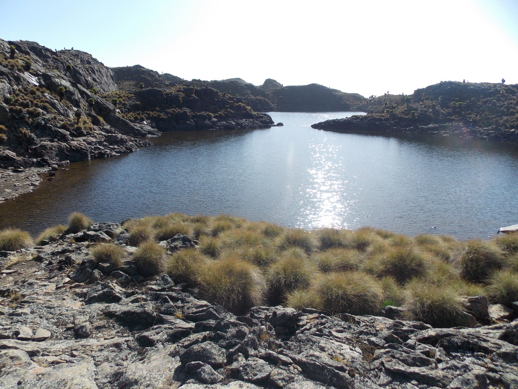
This route leads from Chogoria town up to the peaks circuit. The rough and muddy 32km road, from the forest gate to the park gate, is often done by a 4x4 vehicle, but it is also possible to walk (given an additional day). There is plenty of wildlife to be seen in the forest, from safari ant columns crossing the track, and monkeys in the trees, to the potential for seeing elephant, buffalo and leopard, not to forget the numerous birdlife. Near the park gate, the bamboo zone starts, with grass growing to over 12m high. Once in the park, the track passes through rosewood forests, with lichens hanging from the branches. At one point the path splits, with the smaller track leading to a path up the nearby Mugi Hills and across to Lake Ellis. Near the trail head a small bridge crosses the Nithi stream. (Following the stream down- river a few hundred metres leads to The Gates Waterfall.) The path heads up a ridge above the Gorges Valley, with views to the peaks, Lake Michaelson, The Temple, and across the valley to Delamere and Macmillan Peaks. Hall Tarns are situated right on the path and above a 200 metres (660 ft) cliff directly above Lake Michaelson. This route is the most scenic route of all and is often used as a descent route.
|
|
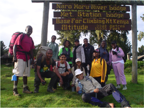
NARO MORU
|
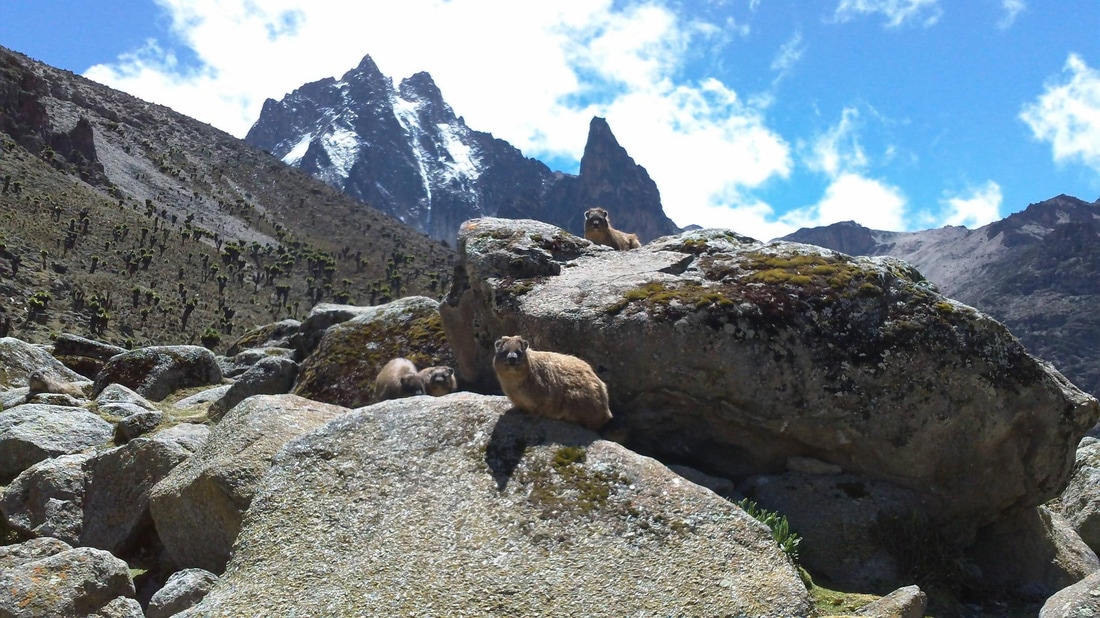
The trek starts in Naro Moru town and heads past the Park Headquarters, up the ridge between the Northern and Southern Naro Moru Rivers. It is comparable to the Sirimon Route, in terms of hiking distances to the various camps, as well as altitude gains at the end of each day. The distinguishing factor is the vertical bog conditions, which can be quite the adventure during the rainy seasons. The route drops down after the road-head past the Meteorological station into the Northern Naro Moru Valley to Mackinder's Camp on the Peak Circuit path. This route is advised over 4 days though an extra day for acclimatization can be added, thereby increasing the success of the summit attempt up point Lenana. Unless preferred, camping is not necessary as accommodation is available in mountain huts throughout the trip. The forest is dense on this route, as is the bamboo zone. You are very likely to wildlife such bushbuck, Colobus monkey and Sykes Monkey and Buffalo and Elephant tracks and on the approach to MacKinders, you are almost guaranteed to see Rock Hyrax. The hygenia forest is full of flowers and other plants with the Teleki Valley full of the classic Tree and Cabbage Groundsels as well as Lobelia Telekii and Deckenii. Some of the cabbage groundsels in particular are absolutely massive.
|
KAMWETIThe Kamweti Route approaches from the south by first driving up from the village of Kutus to the Forest Castle Lodge in the forest zone. You can begin the trek at the lodge or drive a further 6km up to the Kamweti Forest Station at around 2600m. This trail begins on the southern side of the mountain up a trail from Kerugoya Town. This trail is a fairly challenging one on rough terrain through a dense montane forest with lush groups of giant bamboo before emerging out onto a ridge and along to the head of the Kiringa river where it flows out of a large bowl in the mountainside. The next 10km or so sees the heath thin out as the trail reaches a feature known as The Scoop, at the end of a long ridge leading to the peaks. From here the route options are to follow the ridge along to Austrian Hut via Tilman Peak or to traverse West round to MacKinders Hut via lake Hohnel. On this trail you are very likely to see more elephants than hikers until you get to alpine rock terrain!
TIMAU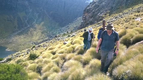
|
The Timau Route approaches from the North from the village of Timau. This route used to be a popular for ascending in a 4x4 as it follows the gentler northern slopes until they steepen at around 4200m. From here it quickly drops into and across the Hinde Valley and the Nithi North river before once again climbing up to meet the Chogoria Route at Hall Tarns. Conditions may greatly vary on this route- vehicles generally do not ascend above about 3400m.
|
What we include....
All of our expeditions include a full service crew, a personalised menu and private transfers
Professional Service CrewAll expeditions included a Camp Manager, professional guides, mountain chef, personal and general porters
|
Personalised MenuGluten-free? Vegetarian? No problem- our chef will personalise the menu to ensure that you are energised!
|
Private transfersNeed a safe ride to the gate? We offer safe and secure private transfers as required
|